Hydrometeorological hazards have outnumbered hazardous geophysical events such as earthquakes in the last two decades. While geophysical disasters have resulted in more deaths in Indonesia, hydrometeorological disasters have affected more people through injury, displacement, and property damage. Flooding is the most significant hydrometeorological hazard in Indonesia because it occurs more often, affects more people and cause massive and expensive damage. Patronage politics, like those predominant in South Kalimantan, are a crucial factor exacerbating climate disasters, and governments rely heavily on inadequate technological solutions to mitigate floods.
Managing flood hazards has become a focus of the disaster management agenda under Jokowi’s administration. While serving as the governor of Jakarta, Jokowi faced complex flood problems in Jakarta, specifically in 2013 and 2014. When contesting the 2014 presidential election, Jokowi placed floods, especially those in Jakarta, as an important political campaign issue, stating that it would be easier for him to cope with the Jakarta floods if he was entrusted as a president.
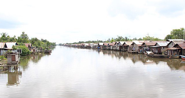
South Kalimantan has two main geographic features, the lowlands and the highlands. Lowland areas are covered mainly by peatlands, swamps, and large river basins. The highlands are a plateau and natural tropical forest. South Kalimantan has many rivers, the biggest is the Barito River. South Kalimantan is also well-known for its wealth of natural resources, as seen from the numerous mining operations in the regions. The province is the third-largest coal mining area in Indonesia. In the last decade, South Kalimantan has also become one of Indonesia’s largest palm oil plantation areas.
To mitigate flooding in South Kalimantan, the provincial government plans to build more reservoirs and dams. This solution is not surprising. Heavy reliance on infrastructure intervention to respond to South Kalimantan flooding is the dominant feature of Indonesian flood management. This strategy has been adopted in many cities and regions throughout the archipelago. Since the start of his tenure, President Jokowi has focused on managing flood hazards by stipulating flood management policies that rely on large-scale technical interventions such as giant sea dykes, dams, reservoirs, polders, canals, water tunnels, and river normalisation. Normalisation is achieved by installing infrastructure that cleans the river and removes obstructions.
However, technical intervention should not be the only game in town. The predominant approach not only potentially overlooks social factors but also actively obscures the political dimension of Indonesia flood management. Dependence on large scale technical intervention is insufficient to confront the inevitable danger inherent in the destructive impact of climate change. The intensity of flooding will increase in the future. Adaptation strategies must also emphasise long-term structural prevention. Without any intervention on the established political structure, it will be difficult to develop effective prevention. The characteristics of local politics seem disconnected from the dynamics of flood management policies, but are decisive for the outcomes. Flood management is likely to be less successful in a region with strong clientelist politics, a high prevalence of corruption, and weak civil society and political opposition. These situations mean Indonesian people in an urban setting or rural context remain vulnerable to flood hazards in the long term.
The case of South Kalimantan province reflects the linkage between politics and flooding. Predatory political-economy elites caused massive environmental damage and undermine spatial sustainability. The land-use change along the Barito River Watershed transformed the green zones and water catchment areas into extractive industries. When extreme rainfall occurs, the Barito River is incapable of accommodating the water overflow and exposes people to flood hazards.
Floods and forced evictions in Jakarta
People, politics and planning collide in riverside slum Kampung Pulo.
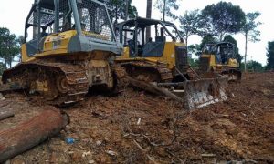
Environment and civil society activists in South Kalimantan claim that massive expansion of mining and oil palm plantations have contributed to the flooding. Based on satellite imagery data, The National Institute of Aeronautics and Space of Indonesia indicated that around the Barito River Basin forest areas have decreased by over one hundred thousand acres, while plantation areas have increased to over two hundred thousand acres. Merah Johansyah, coordinator of Jaringan Advokasi Tambang (JATAM – Mining Advocacy Network), proposed that of the 3.7 million acres of the total forest area in South Kalimantan, 1.2 million ( 33%) belongs to mining companies, and 620,000 acres (17%) are owned by oil palm plantation companies. This means half of the forest area in South Kalimantan has recently been exploited by mining and plantation industries. Many mining licenses violate regional spatial planning purposes.
Local academic, Uhaib As’ad, has spent most of his scholarly career observing politico-business linkages in South Kalimantan. He found that the mining bosses funded candidates in numerous local elections. In an article with Edward Aspinall, they argued that the center of gravity of South Kalimantan is resource rent-seeking that involves bureaucrats, politicians, security officials, and others who seek access to mining permits, official revenues, and illicit payments. This patronage network means coal mining bosses can grasp privileged influence on the incumbent administration, especially in regard to coal mining licenses and concessions. These lucrative practices have flourished since the early decentralisation era in the 2000s. Some institutional initiatives have improved natural resource exploitation, but the damage has been done for environmental sustainability. For instance, the provincial government has issued post-mining land rehabilitation and mining transportation regulations to avoid more destructive effects on the environment. However, illicit payments to government officials made it difficult to enforce the regulations.
One of the worst-hit flood spots is in Tanah Laut District. At the same time, Tanah Laut is the third-largest coal producer district in South Kalimantan. Aspinall and As’ad argued that Adriansyah, a former head of district from 2003 to 2013, was a typical patronage politician who controlled oil palm plantation and mining licenses. He was arrested by the KPK (Corruption Eradication Commission) in 2015 for receiving bribes from a businessman in exchange for a mining license. Adriansyah was locally regarded as a populist leader with popular policies in agriculture development, rural infrastructure, and assistance for farmers’ groups. This kind of political environment makes it difficult for strong civil society opposition to consistently demand government accountability.
The Indonesian approach to flood management and climate adaptation should not neglect political factors. Large scale technical interventions are important to provide flood protection. However, we need transformative change to deal with the imminent threat of climate change. This agenda is a political choice. Public scrutiny of spatial planning is equally, or perhaps more important than interventionist infrastructure in the long term. The South Kalimantan case offers insights into how lucrative politico-business linkages make people vulnerable to climate hazards. Floods occur because of extreme weather events, but they turn into disasters if and when people and communities are left vulnerable. This makes disaster an inherently political concept as shifts in vulnerability and inequality are always (also) the consequence of political structures, decisions and policies. Floods are physical occurrences but their form, magnitude, location, and effect on people are the outcome of past and present political processes. It is time to bring politics to the centre of analysis in disaster management in Indonesia.
 Facebook
  Twitter
  Soundcloud
  Youtube
  Rss
Rss 


